Geospatial, Aerial Patrol, & Full Motion Video
The Rugged Video Geospatial Video Recorder with FMV integrates multiple video channels with GPS and can be paired with Geospatial software to view multiple video channels and a synchronized flight path. The most common use for this Geospatial Video System is pipe and power line inspection, however, systems can be used for aerial surveys, corridor mapping, and transportation.

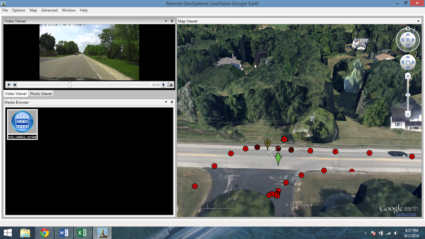
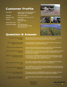
Screenshot of Flight path in Google Earth
GPS/Software
As a GPS Video System, data can be logged as a standard KML or GPX file in addition to being overlaid as text right on the video. KML and GPX files can be viewed using software like Google Earth or can be played through specific Geospatial software (we have a variety of versions dependent on application)
Record/Waypoint Triggers
In addition to the 3D flight path, waypoints can also be captured using a waypoint trigger. Waypoints appear in the GPX file as tag for easy reference of noteworthy points from the flight. A separate record trigger can also be connected so you capture only footage specific to the clients needs. An LED built directly into the toggle indicates record status so the pilot knows they are capturing valid video and data.
Overlay
In addition to GPS data files, important GPS data can be recorded directly on the video. For customers without specialized software packages, screen shots with coordinates displayed prominently on the screen can be captured in flight or post process and emailed to the end clients. Data available for overlay: Coordinates (in three formats), speed, altitude, and heading. In addition, custom text can be overlaid on the video in real time or it can be set up prior to a flight. Have as much or as little information right on the recorded video.
Cameras/Gimbal Integration
Choosing the proper camera to fit your needs is essential. The RV recorder product line can record video from almost any high definition or standard definition camera on the market. Rugged Video supplies custom made adapter cables to make the integration with any existing cameras plug-and-play. For customers who also require cameras, Rugged Video offers a line of HD cameras with a variety of lens options ideal for geospatial recording. Please contact us to talk more about integration with your existing cameras.
Fault Tolerant
The RV recorder line also features black box functionality. In the event of a workflow issue or power loss while recording, the Commander has the ability to stop recordings and safely power down, potentially saving thousands of dollars in footage already shot.
Multilink
The ability to link two or three channels of video together can increase efficiency. With the synchronous triggers, systems are controlled with a single record and waypoint switch. Unit stacking also allows for the system to be upgraded in the future by adding additional channels. Units are stacked with side plates that screw in place, a multilink cable, and power cable. It is that easy to add a second or third channel to the CRUSADER. We also have a few versions of recorders that are built specifically for geospatial applications, such as our Aerial Patroller.
GPS Integration
RV recorders accept standard NMEA GPS data via RS-232. A Garmin 18x GPS antenna/receiver is included with each geospatial system, however, external GPS units may be used instead. GPS interface cables are also available for use with an external GPS/NAV, Flight Deck, or Portable GPS. GPS data can be logged at 5Hz or 1Hz based on the GPS sampling frequency.
Camera Connectivity
The Rugged Video recorders can accept video from SD and HD cameras with the following outputs: 3G-SDI, HD-SDI, SDI, HDMI, DVI, NTSC, and PAL. Other signals, such as component and S-video, can also be recorded using Rugged Video supplied or commercially supplied adapters. Rugged Video also features a variety of HD cameras with various lenses suitable for geospatial use.
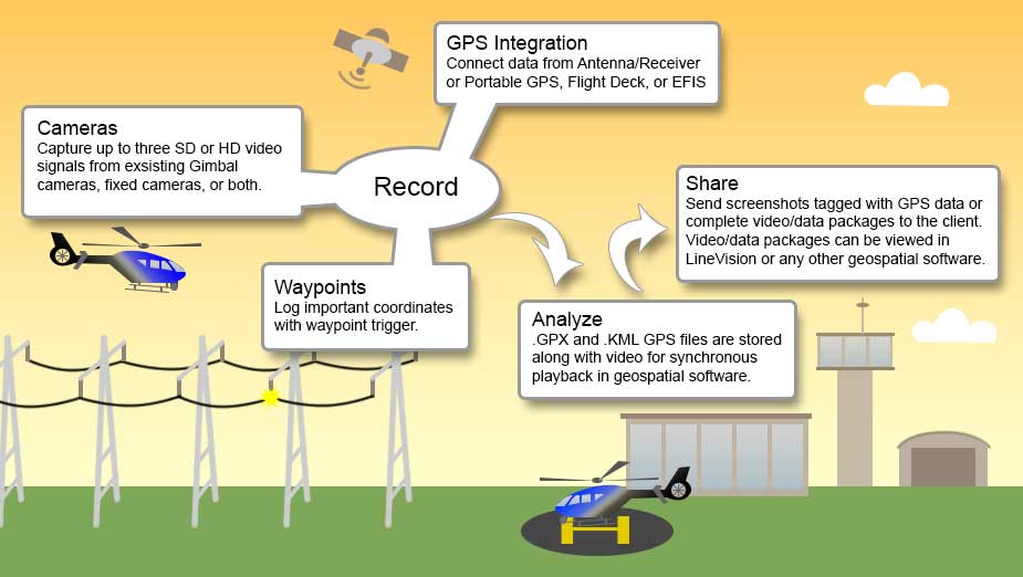
Geospatial Workflow – Click to Enlarge
Collection of Video/Data
When power is supplied to the RV recorder, it will display a GPS status LED and a fault LED. Once a GPS lock is obtained, the media is properly mounted, and cameras have come online, the operator can begin recording via the command of the record switch. Video, audio, and GPS data are recorded to a USB Flash Drive (or SD Card). While in flight, the pilot can monitor the record, fault, and GPS status lights to ensure proper operation. Noteworthy points can be added to the GPS track using the waypoint trigger. Once the flight is completed, the pilot can stop the recording via the switch and remove the media.
Analysis/Software
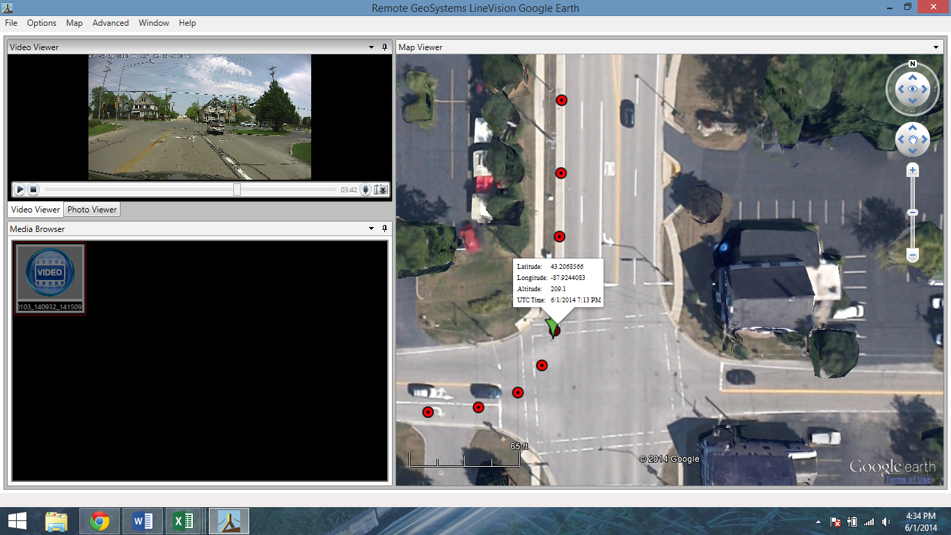
Screenshot of Flight path in Google Earth
Video and GPS data is downloaded for viewing and analysis. Video and data can be imported to geospatial software or they can be viewed separately using a media player for the video and Google Earth for the GPS data. For more information on the other available softwares, please contact a Rugged Video Rep.
Copies of Video for Customers
Having the file saved to a USB makes customer inclusion easy. Need proof that you flew a certain area? You can duplicate the video file and GPS file to provide a physical copy to the customer. With the GPS overlay options, your coordinates, altitude, speed, and heading can appear right on the recorded video.
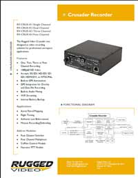
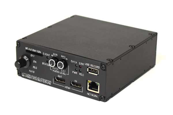
Crusader Brochure – Click to Enlarge
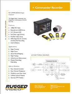
Commander DVR – Click to Enlarge
Click here for Aerial Patroller
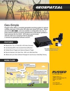
Geospatial Brochure – Click to Enlarge
Customer Profile – Due North Aviation – Click to Enlarge
Due North Aviation – Power Line Inspection